City of Hobart Open Space Strategy

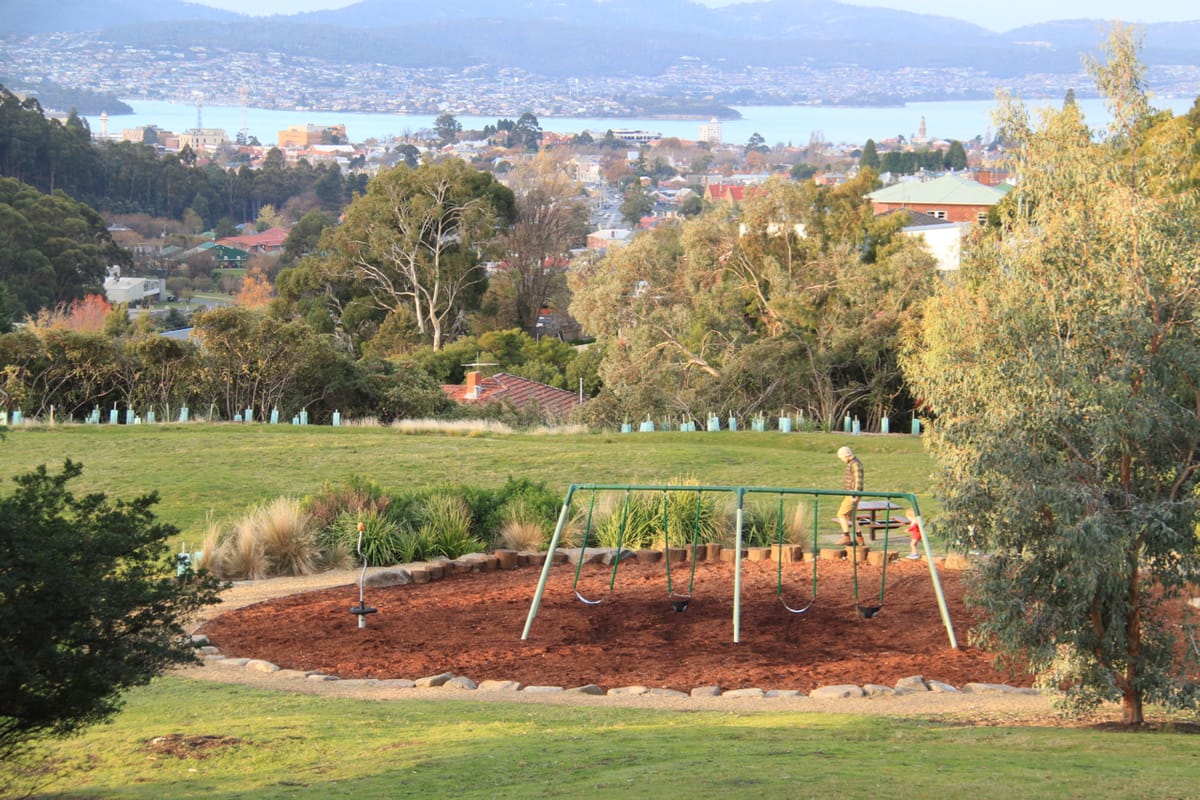
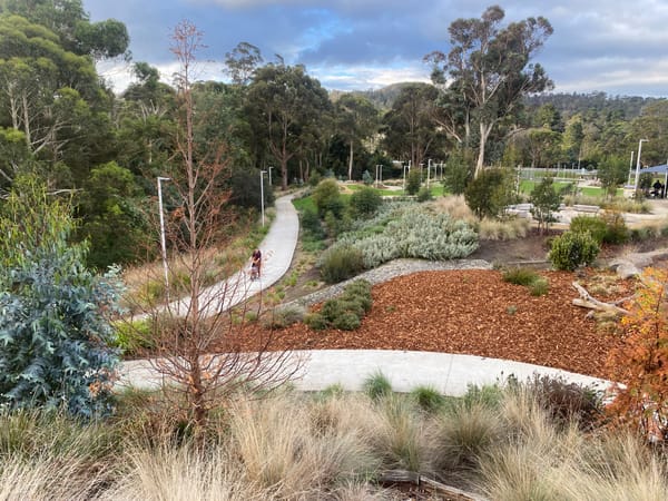
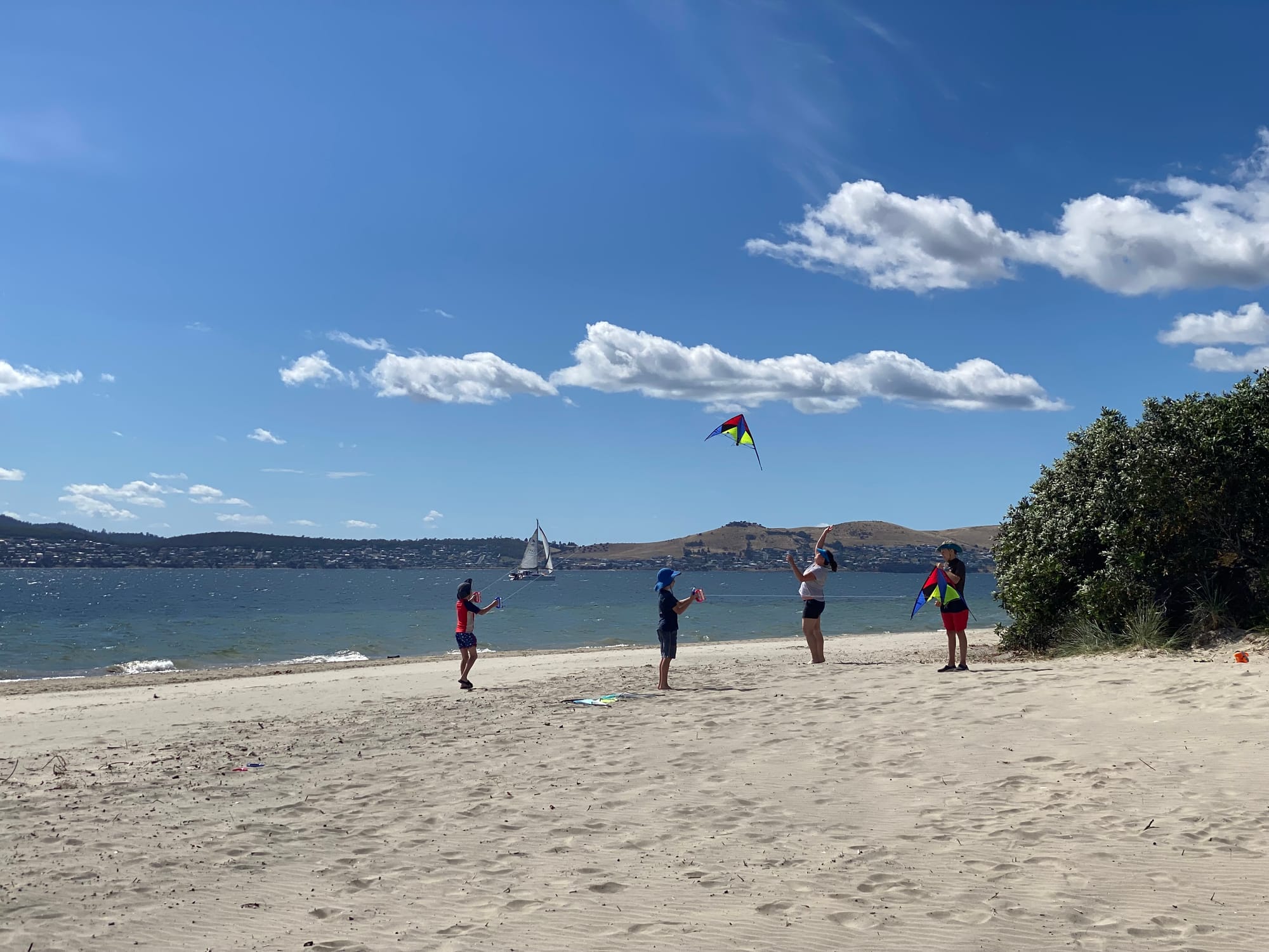
Hobart's beaches, bushland reserves and parks are places for activity, contemplation, gathering and play. These open spaces are home to an abundance of native wildlife, plants, woodlands, forests and grasslands.
Over the past two years, the City of Hobart held two extensive community engagement processes to understand how the community values and uses these spaces, and what changes it desired. In October 2025, Council published a draft Open Space Strategy that outlined how it would manage and improve these areas over the next decade.
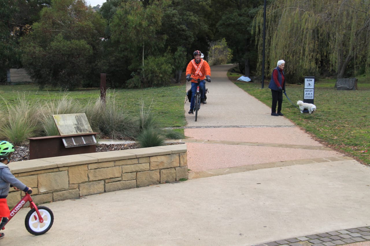
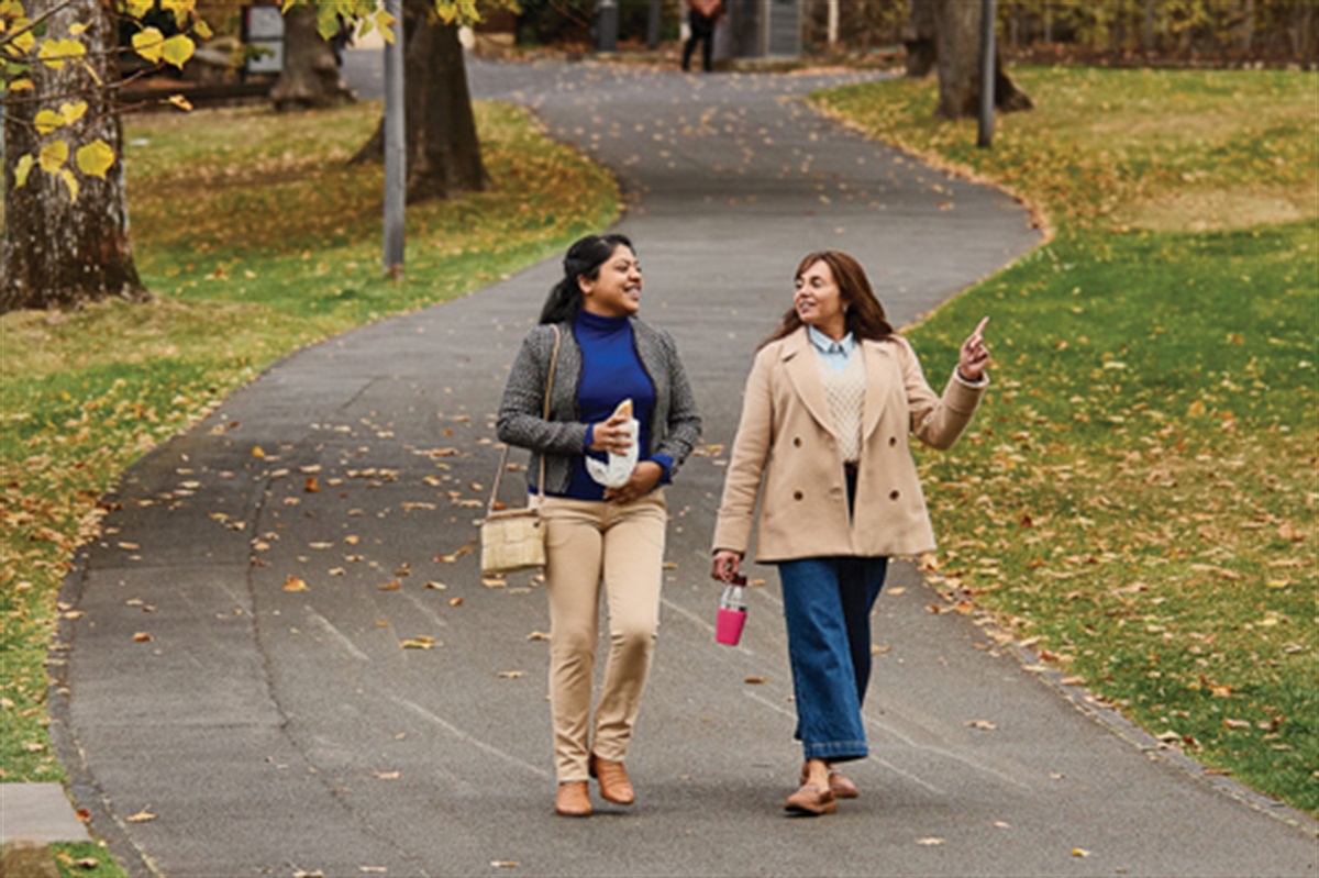
Findings from the survey for the draft strategy included that active transport was the most popular way of accessing open space, with 54% walking and 5% riding. A further 37% drive, and 4% use public transport. Improving connections between residential areas and open spaces was identified as important, with the Cornelian Bay to Queens Domain identified as a significant missing link for these two open spaces.
The most popular open spaces were Queens Domain/ Royal Tasmanian Botanic Gardens, followed by Kunanyi/Wellington Park, Knocklofty Reserve and Hobart Rivulet.
There was a clear desire for more open space in Central Hobart and North Hobart, with over 50% of survey respondents identifying these two areas as the highest priorities.
The strategy also identifies an action to increase the presence of Palawa kani (Tasmanian Aboriginal) words/languages in signage used in open spaces to ensure that signage recognises Aboriginal connection to country.

Noting Hobart has an ageing population, another key action is to develop a dementia friendly sensory garden in one of our parks.
Of the 46 actions within the Strategy, other key actions include:
- Assessment of facilities and equipment for older children and teenagers – such as skate parks, basketball half courts and pump tracks.
- Improving lighting in open space active travel corridors.
- Developing a recreational track and trail action plan to improve Hobarts recreational track and trail network (to include links between open spaces such as parks and bushland).
- Planning for a flagship urban ecological restoration project.
- Creating a biodiversity-centred ‘welcome information pack’ for new residents in key, high value conservation areas.
Council endorsed the strategy in March 2026, and the final document is now available. Find it on the City of Hobart website linked below and continue reading for Streets People Love Hobart's submission that helped shape this strategy.
Streets People Love Hobart
Submission to the City of Hobart
Draft Open Space Strategy
12th November 2025
Prepared by SPLH members
Endorsed and submitted by Mark Donnellon
Contact perci@streetspeoplelovehobart.au
Thank you for the opportunity to contribute feedback on the draft Open Space Strategy (the draft Strategy).
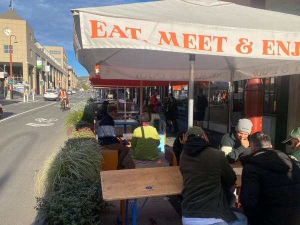
Streets People Love Hobart is a community-led initiative organised by a passionate group of local advocates. Our mission is to engage people and advocate for streets that prioritise people, safety, and sustainability. We believe Hobart deserves vibrant, welcoming spaces where everyone can connect, move, and thrive. We also have the support of numerous businesses across the city who share this vision.
We strongly endorse the draft Strategy and commend the Council on its leadership to enhance the natural and recreational areas that make Hobart a great place to live, work and play. When we think back to even a decade ago, the city has considerably improved its management of parks, playgrounds and bushland areas. Playgrounds such as Legacy Park, and improved access to the lower flanks of Wellington Park such as ‘Knocksofty’ and Gentle Annie trails, have been significant improvements to the city amenity.
Members of our group have read the Framework, we endorse the five principles, and they align with what our members want to see improved in Hobart. Note that where we have not commented on a section, we are supportive of the actions as listed.
The strategy highlights the vast number of open space assets that Council manage, with over 250km of tracks and trails, 100+ parks and reserves, and 51 playgrounds across the Council. We are cognisant that Council allocated approximately 31% of the 2024-25 budget to a cluster of work programs that are bundled as “Fostering an Active Lifestyle” (comprising expenditure on maintaining parks and reserves, bushland management, sportsground infrastructure, and Aquatic centre)[1].
Given the Council’s investment in these existing facilities, would it offer a better return on investment to prioritise improvements to active transport connections to these existing reserves? (i.e. instead of building additional parks as implied by maps on pages 49, 51 and 52?). With the increasing use of e-bikes, adaptive e-trikes and other micromobility solutions, it would be feasible for many residents to access a greater range of parks (than a 400m radius) within 5-10 minutes. It would not only support Goal 4.3 (and the four underpinning actions) but also tie in well with existing Council strategies, notably:
- Central Hobart Plan - the “Green and blue network’ that was outlined in the Executive Summary (p.25),
- Hobart Transport Strategy (Choice in how we move, p. 41-43, Safe and Healthy Streets, p. 50-57, and Climate Ready Transport, p. 58-62) and
- Parking and Kerbside Management Plan (Active Transport, p. 38-39).
We also consider that any improvements to active transport, such as defined routes connecting to local, district or regional significant parks or open space, could also function as biodiversity corridors. As the Hobart Transport Strategy outlined in “Safe and Healthy Streets” (p. 53-54) this approach will not only alleviate stress and cool the street through natural means for us humans (and helping to alleviate climate change in a number of ways), but also provide green corridors for greater land-based biodiversity (eastern quolls, Tasmanian devils and other native marsupials have been increasingly sighted within the streets fringing the CBD).
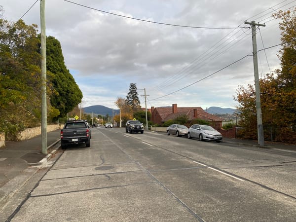
If Council does determine that building more parks is a necessity, to achieve the 400m walking radius, then we suggest it consider strategic street closures to achieve this public open space. This form of ‘pocket park’ has been implemented in many inner urban Councils across Australia[2], to achieve with multiple benefits: traffic calming, more green space, community connection, and improved urban biodiversity. The sections of Sandy Bay, North Hobart, West Hobart that are showing as lacking in parks have wide through streets where this solution is possible.
Principle 2 - Nature positive
We strongly support the signature action of a flagship urban ecological restoration project.
We offer two suggestions in relation to Goal 2.3 - Nature threads through our city:
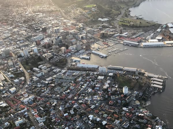
- Continued restoration of the Hobart Rivulet. This would build upon the Council’s decades long investments in improving the Rivulet Track (and recent McRobies Gully GPT installation) to improve water quality, and ongoing work by the Rivulet Bushcare group to remove weeds and reinstate native vegetation. The transformation of the Collins St corridor would help people transition from the heart of the city to the Rivulet Track, or Queens Domain, within 5 minutes on mobility scooter, e-trike, bike, or 10 minutes on foot or with pram.
- Currently the four major roads that offer the connection from city to North Hobart are very asphalt dominated (Harrington, Elizabeth, Argyle and Campbell). We could see huge benefits to the city by having just one of them transformed into a boulevard where people moving by public transport, active transport were prioritised. Some inspiration has already been provided via the RACT Greater Hobart Mobility Vision 2030 (refer page 15 for artist’s impression).
The following case studies from interstate and overseas show possibilities for Hobart in this respect:
Bourke St cycleway - a 3.4 km active transport corridor across a traffic-congested area of inner city Sydney. It is also an active, green recreation site use by local families, leisure riders, and children travelling to and from school.
Grey to Green - inner-city Sheffield, the city has transformed a tarmacked area into a green public space that encourages cycling and walking. It offers a calm refuge in an urban environment, and its innovative drainage system reconnects this part of the city with its waterways, flowing rainwater back to rivers in a way that mimics nature – cleanly, slowly, sustainably.
We trust this is helpful in refining the Strategy.
Yours sincerely
Mark Donnellon
President,
Streets People Love Hobart
[1] Graphic shown as part of https://yoursay.hobartcity.com.au/community-budget-26-27
[2] https://www.unley.sa.gov.au/Development-projects/City-Projects/Past-projects/City-Design-Pocket-Parks